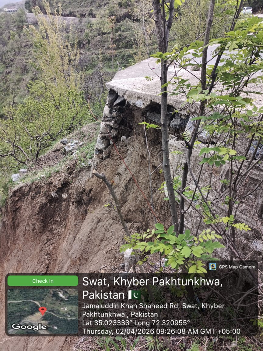
Aghal Lilbanr Road
Not restoredThis activity provides a detailed overview of the operational status of the Road Aghal Lilbanr Road, recorded on 1 April, 2026. The affected site is situated within the Swat district, operating under the administrative jurisdiction of XEN Swat II Matta. The infrastructure has been primarily affected by Retaining Wall, encompassing a total span of 0.05 Kilometers.
Restoration and clearance efforts were facilitated by the deployment of N/A , which remained in active operation for a duration of 00 hours . In a formal assessment of the situation, the reporting officer noted with remarks: Currently in a highly vulnerability state as per observation made of significant scouring and settlement which, if left unaddressed, will inevitably lead to a major slide or complete collapse of the carriage-way. The topographical challenges at this specific site are considerable. There are visible signs of active soil erosion and road settlement, which pose a direct threat to the structural integrity of the carriage way..
The affected area has been mapped using geographic coordinates. The section starts at 72.321222, 35.023242 and ends at 72.320797, 35.023608. For location reference and navigation, view the route on Google Maps.
Comprehensive efforts are currently underway to arrange additional resources and manpower to ensure that the road is restored to a safe and usable condition as soon as possible.
The following photographs provide a visual record of the site conditions before and after the activity, illustrating the extent of the affected area and the improvements achieved through the executed operations.
Before Images (1)
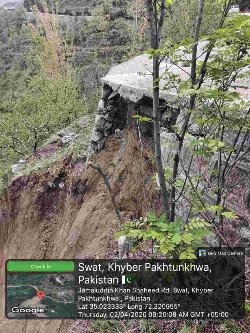
After Images (1)